Aerial Real Estate Photography: How to Sell a Home Faster and More Expensively Using the View From Above
Are you selling a country house, a plot of land, or a commercial building? In 2026, standard "eye-level" photos are no longer as effective. A buyer scrolls through hundreds of identical listings in a single minute.
To capture their attention, you need to show the scale. Aerial drone photography is a marketing tool that, according to statistics, increases ad click-through rates by 68% and speeds up the deal.
What a drone shows a buyer (that a standard camera cannot)?
Interior photos are important, but they don't sell the location. When buying a home, location accounts for 80% of the success.
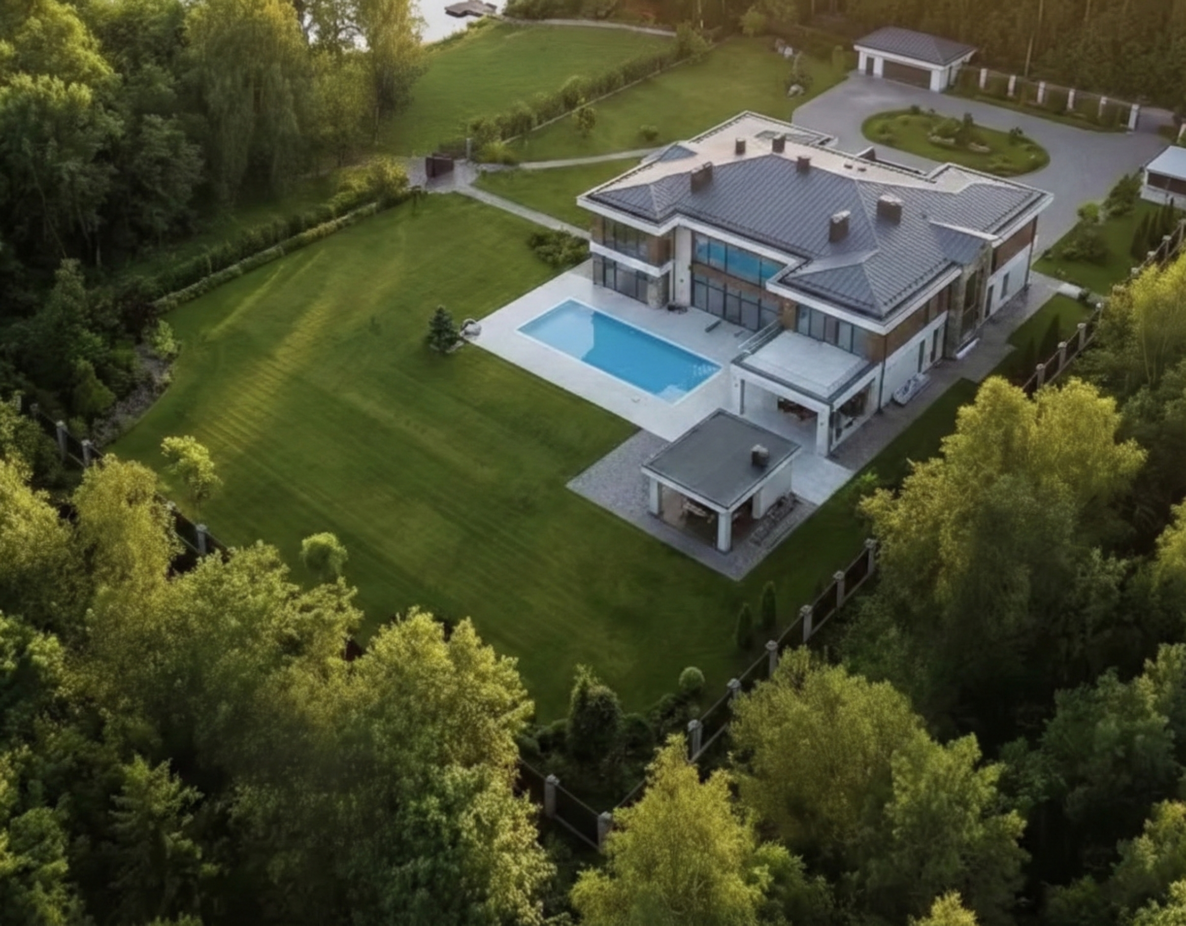
Real boundaries and property scale
From the ground, it is impossible to show 20 or 50 acres in their entirety—only the fence and the lawn are visible. An aerial view allows a single shot to demonstrate the full scale of the estate, the landscape design, and the geometry of the plot.
Infrastructure and surroundings
The text "near a forest and a lake" works less effectively than a single drone video where the camera smoothly flies from the porch of the house to the riverbank. We don't just show walls; we sell a lifestyle: proximity to nature, good roads, and the absence of noisy neighbors.
Numbers Don't Lie: Why Aerial Photography Pays Off
An investment in high-quality real estate production is pennies compared to the property's value, but the effect is colossal:
- High CTR: Listings with a video cover receive priority in search results on real estate portals.
- Trust: Professional filming immediately elevates a property to "premium" status, even if it is a standard cottage.
- Filtering out "tourists": A detailed video flyover filters out those for whom the location is not a fit, saving the realtor's time on unproductive viewings.
Which formats do we offer?
We create content that sells for you.
Selling videos (Reels/YouTube): Dynamic editing with music, infographics showing property boundaries, and emphasis on key advantages.
360° Panoramic Photos: The ability to turn one's head and look around the house directly from a smartphone screen.
Orthophotomaps: For large plots and developers—an accurate map of the area with cadastral boundaries overlaid.
Book a shoot that pays for itself with the first sale.
We know how to showcase your property from its "best side." We operate in Warsaw and travel throughout Poland and the EU.
Contact us to receive portfolio examples and a price list for realtors.
Spectacular aerial shots — in just 24 hours
Tell us what needs to be filmed — and we’ll do it beautifully, quickly, and safely.